1520 - 1700
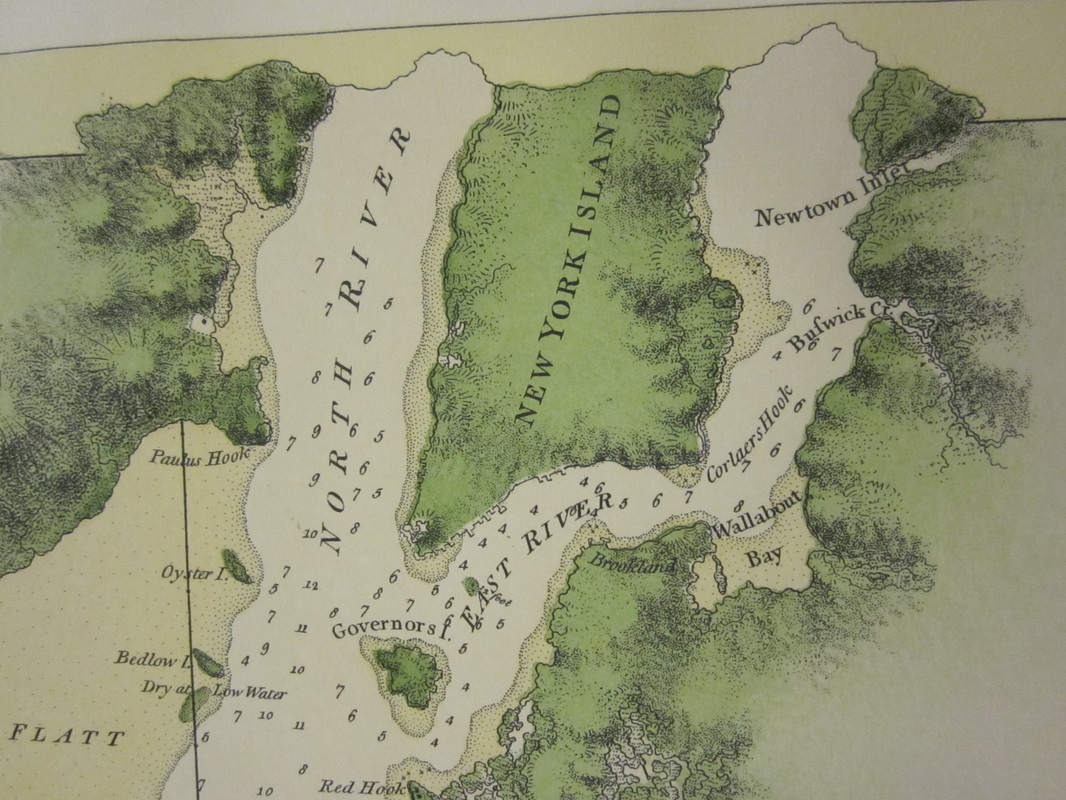
"A Chart of New York Harbour with the Soundings Views of Land Marks and Nautical directions for the Ufe of Pilotage. Compofed from Surveys and Observations of Lieutenants John Knight, John Hunter of the Navy, and Others." Published by J.F.W. Des Barres Esq. May 19, 1779
The land Williamsburg occupies today was once very fertile and heavily wooded. It was bordered on the west by the East River, by Wallabout Bay to the south, and farther north by Newtown and Bushwick Creeks, respectively. There were lowlands around the river as well as creeks and salt marshes to the north where Greenpoint is today. This is hard to imagine in the context of present day Williamsburg, which is characterized by dense housing and high capacity transportation systems aimed at moving people and cars. The presence of humans, be it the first native inhabitants, Dutch settlers, or the present day communities, has changed the terrain of the area dramatically. Hundreds of years of manipulation of the landscape has resulted in vast alterations to the fluvial and biological geography of the area, as can be seen on the shoreline of the East River where large amounts of infill have created more land for industry, and where dense woods and fertile soil have been traded for all things required of a growing, urban society. Even with the massive changes the area has undergone, pieces of pre-urban Williamsburg still resonate in the area today, such as street names, town names, land parcel boundaries, and transportation and trade routes.
