Brooklyn - Queens Expressway
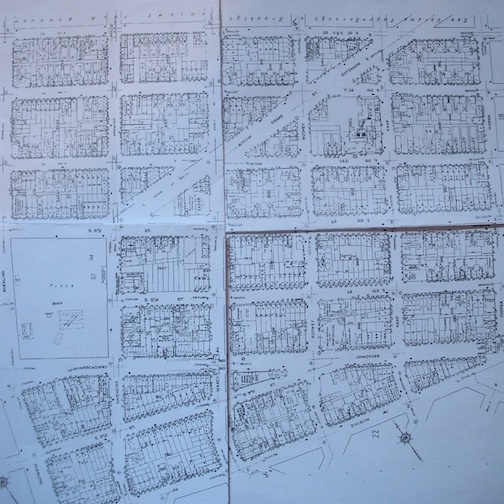
Before the BQE, 1918. Sanborn Fire Insurance Maps
The influx of cars and immigration in the 1920s and 30s created a need for an expressway connecting Brooklyn and Queens. Construction of this expressway, the Brooklyn-Queens Expressway (the BQE), began in 1937 under Robert Moses. As in most highway construction endeavors, Moses had to deal with the issue of resident displacement in the communities through which the BQE would cut. Moses knew that residents would be unhappy about being relocated due to construction, but he felt that it was part of their civic duty to comply.
Construction of the BQE between Williamsburg and the Kosciuszko Bridge began in 1946 and would prove to be devastating to Williamsburg. In order for the BQE to make its path through the neighborhood, ten of its most populated blocks would have to come down. This would result in massive resident displacement. Robert Moses explained that they had a legal right to relocate residents, but offered few solutions. Although many were offered compensation, residents did not want to leave the neighborhood they loved.
Demolition in Williamsburg began in 1948 and the entire length of the expressway was opened to traffic in 1952. The structure slashed through the business district on Broadway and bisected the cohesive community of Orthodox Jews, Italians, Poles, Slavs, and Russians. It is estimated that about 5,000 people were displaced. People either completely moved out of Williamsburg or moved into the more middle-class areas. According to New York City Census data, tracts bordering the BQE lost 8.9% of their population between 1950 and 1960. While the current residents were turned off by the dilapidated state of what housing was left in their neighborhood, it offered two poorer groups an affordable place to live. During this time, there was an influx of Hasidic Jews from Hungary into the area that had once been home to mainly Orthodox Jews and Puerto Ricans began to scatter themselves in concentrated Hasidic areas making for less social cohesion. As the neighborhood remained poor, property owners did not maintain their buildings and capital investment stayed away. Manufacturing activity declined and urban blight set in as crime, arson, and drug abuse rose.
Although the BQE is estimated to carry up to 160,000 vehicles per day through Brooklyn, its construction destroyed neighborhoods and also did not achieve the free-flow of traffic it had promised. Today’s residents of Brooklyn are rallying for the implementation of changes they want to see. One such change includes constructing decking over sections of the BQE that will harbor green spaces, which is part of the Southside Green Light District Plan.
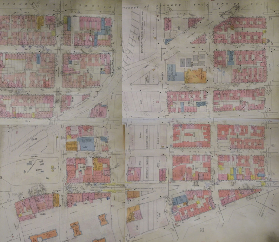
After the BQE, 1978. Sanborn Fire Insurance Maps.
